Download and explore point-cloud data of the National Library of Scotland’s George IV Bridge building.
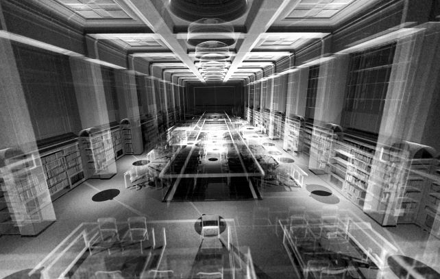
This dataset is a product of two terrestrial-based remote-sensing scanning surveys conducted at different interior and exterior sections of the National Library of Scotland George IV Bridge, including the Reading Room, the Stack Floor and the subterranean Vaults.
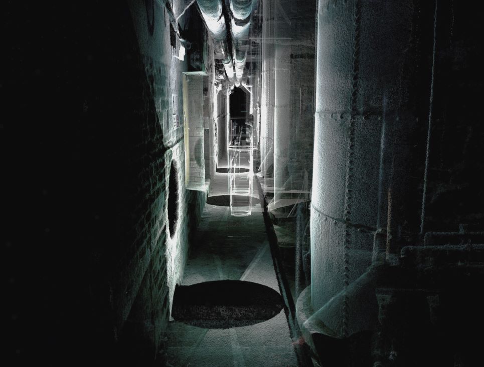
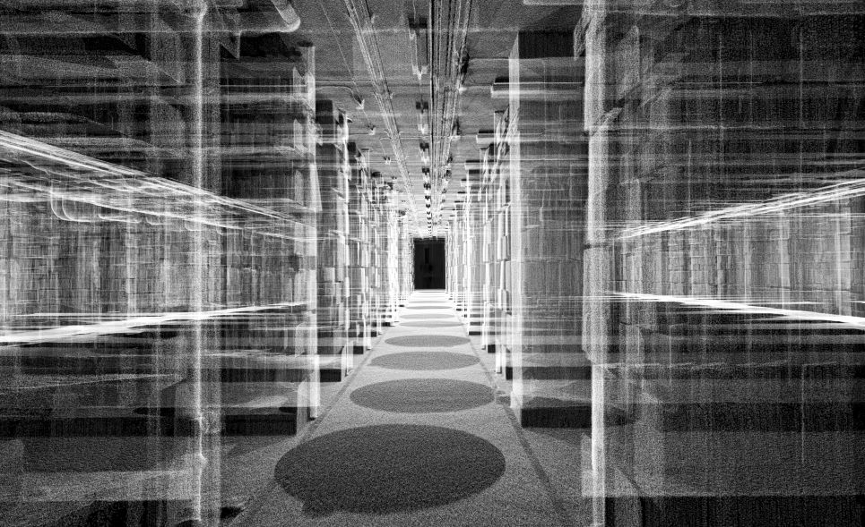
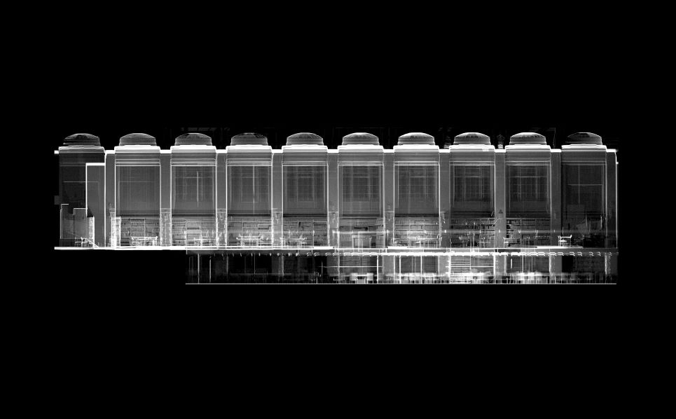
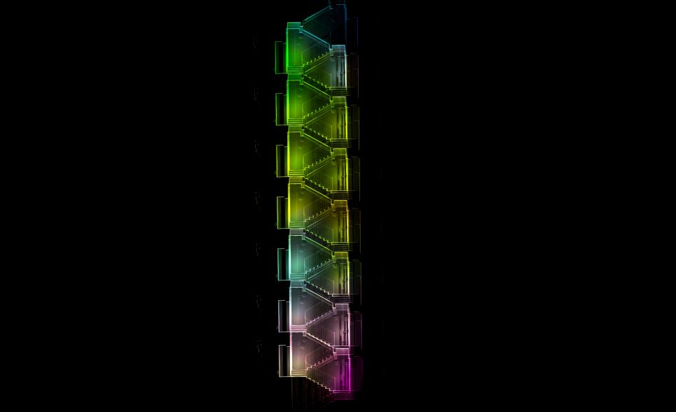
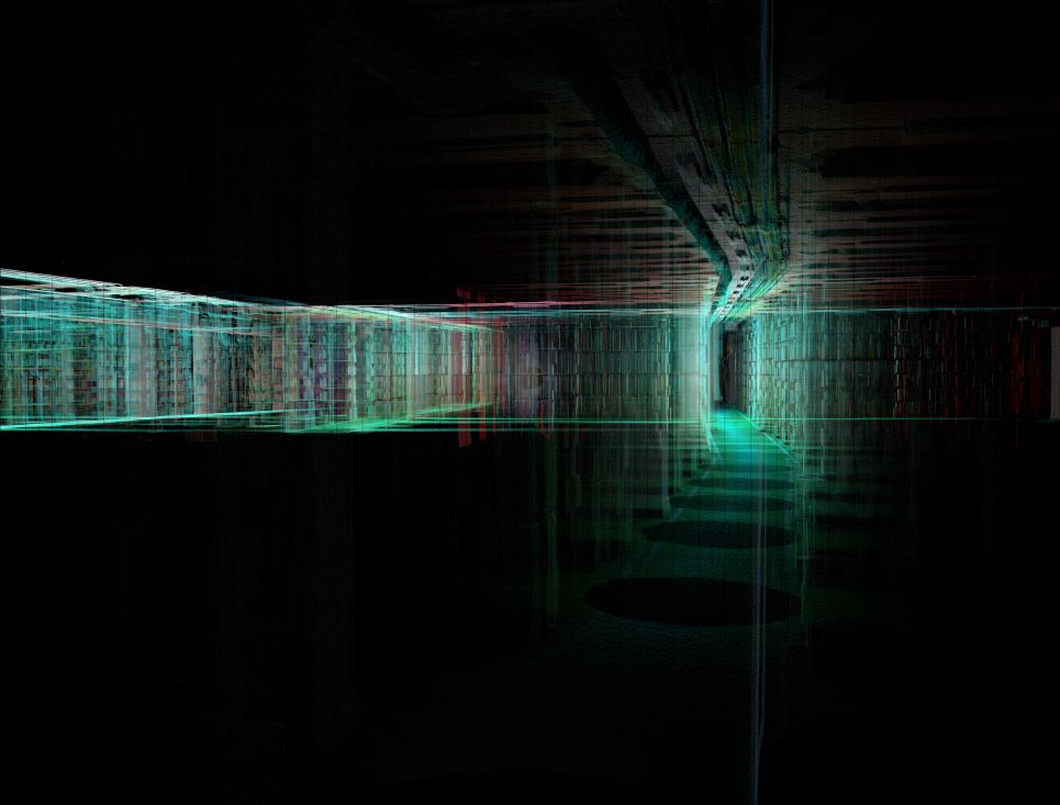
Point-clouds are forensic-grade topographic datasets, retrieved through a particular method of remote-sensing known as Light Detection and Ranging (LiDAR).
LiDAR scanning is instrumental recording of the world through a bat-like chirp of time-stamped photons and laser pulses, and the computational analysis of the returning echoes, using a ground-based scanning instrument. Each echo in a point cloud is categorised in a local Cartesian Coordinates system, appended with RBG colour model and thermal data.
The aim of the scanning survey was to digitise different architectural spaces and reveal spatial and morphological instances of the National Library of Scotland, otherwise occluded to human perception. The point-cloud datasets offer a unique locus to quarantine and record entropies of the built-environment with sub-millimetre accuracy into a three-dimensional model – which can be probed in silico.
The world suspended in a point-cloud when visualised appears as a translucent swarm of data dust – therefore, it also serves a visuospatial paradigm to speculate and anticipate, diagram and animate alternative futures and counterfactual histories of our cultural heritage.
This dataset was created, and text was written, by Dr Asad Khan, University of Edinburgh.
Visit Dr Asad Khan’s website: The Entropy Project
The project was funded by the National Library of Scotland and Edinburgh Futures Institute, with support from the Centre for Data, Culture and Society and the uCreate Studio.
Related resources
More information about how to use LiDAR layers on the National Library of Scotland Maps website: Using LiDAR layers for landscape research
Rights information

This data collection is licensed under a CC-BY 4.0 license.
Download the data
LiDAR point-cloud: George IV Bridge , National Library of Scotland
File contents: 1 plain text readme fileand 5 LASer (.las) files.
File size: 5.8 GB compressed (12.72 GB uncompressed)
Caution: large dataset
Cite the data
DOI: https://doi.org/10.34812/6ch4-rp49
Dataset creator: University of Edinburgh and National Library of Scotland
Dataset publisher: National Library of Scotland
Publication year: 2022
Suggested citation: University of Edinburgh and National Library of Scotland. LiDAR point-cloud: George IV Bridge, National Library of Scotland. National Library of Scotland, 2020. https://doi.org/10.34812/6ch4-rp49