Explore some of the tools we, and others, have available for exploring our datasets.
Explore our range of Jupyter Notebooks analysing Data Foundry collections.

Find our data and code on other platforms.

Find tutorials providing introductions to data analysis tools, using Data Foundry datasets.
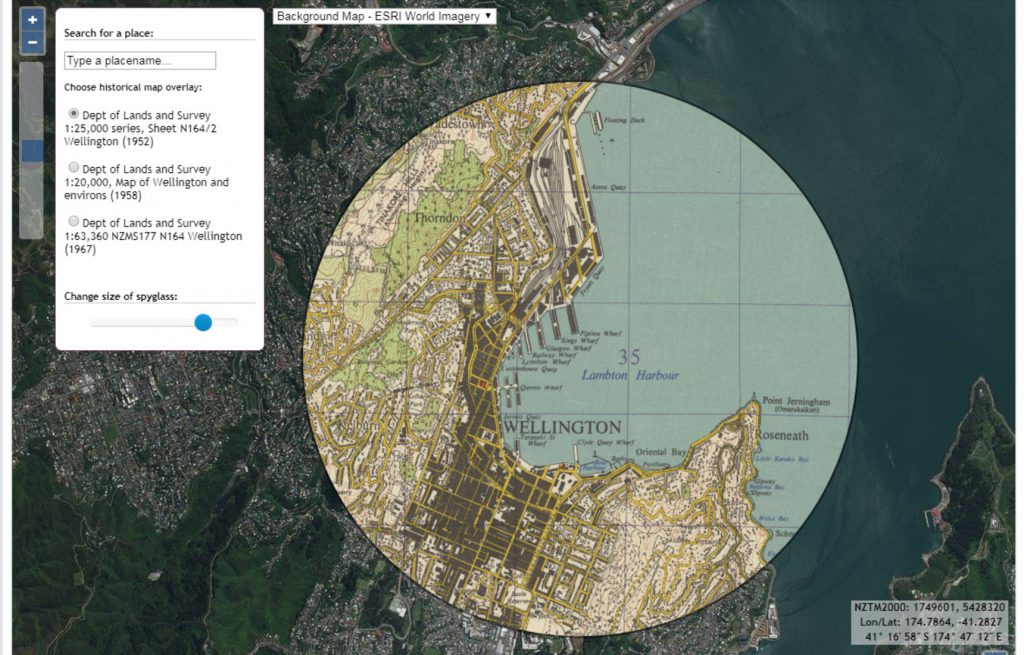
The Library has over 220,000 freely available zoomable maps online on our Map Images website, as well as tools for using georeferenced maps and tools for viewing geospatial data.

There are a number of freely-available tools which can be used to analyse library collections data.