Download and explore data derived from NLS 2nd-edition six inch to one mile Ordnance Survey maps of England, Wales, and Scotland.
This dataset was created by members of the Living with Machines digital history project (The Alan Turing Institute/British Library) while developing the MapReader computer vision pipeline. Living with Machines is a research project that rethinks the impact of technology on the lives of ordinary people during the Industrial Revolution. MapReader creates datasets for humanities research using historical map scans and their metadata as input. Here we share gold standard annotations and outputs from the earliest MapReader experiments.
Using maps provided by the National Library of Scotland, these annotations and outputs reflect labeling tasks relevant to historical research on the Living with Machines project.
Data shared here is derived from maps printed in nineteenth-century Britain by the Ordnance Survey, Britain’s state mapping agency. These maps cover England, Wales, and Scotland from 1888 to 1913.
About the data
The dataset is composed of the following directories:
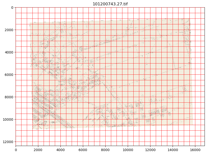
-‘parent’ map images (sheets)
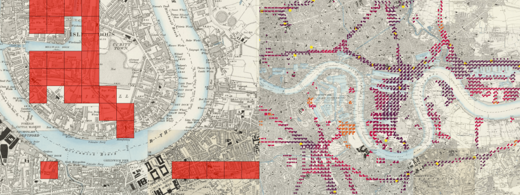
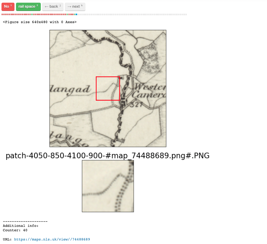
-‘patches’ (100m x 100m map regions)
-62k human-annotated patches (manual labeling by experts) of rail infrastructure and buildings
-30M machine-generated labeled patches (labels inferred by a computer vision model) of the same features
The directory structure is available on the GitHub page for the project.
The unit of analysis is the ‘patch’, a region of the map sheet that is, in this dataset, defined as all the 100m x 100m squares making up the area of the map (not including white space outside the neatline, or map collar). (Patches in MapReader can vary in size depending on the research question.)
The expert-annotated gold standard includes ~62k patches. The total, machine-generated, inferred output created by MapReader includes ~30M patches covering sheets for all of England, Wales, and Scotland.
The data was created by members of the Living with Machines digital history project (The Alan Turing Institute/British Library) while developing the MapReader computer vision pipeline.
MapReader’s documentation includes a User Guide, API documentation, and examples of how to use the pipeline end to end.
What could this data be used for in the future?
-The inputs and outputs can be used to reproduce the experiments reported in our SIGSPATIAL 2022 paper.
-The unlabeled patches (slice_meters_100_100) can be reused for other experiments to label features of interest on the six-inch maps: forests? water? marshland? agricultural areas? canals?
-The labeled and unlabeled patches can be used for creative applications, e.g. visualizing cartographic depictions of the historical British landscape.
-To learn more about possible uses of the patchwork method underlying this dataset, see our Open Access paper, “Maps of a Nation?” in the Journal of Victorian Culture.
More information
For more information about the NLS maps used, please see:
-England and Wales: Ordnance Survey Maps – Six-inch England and Wales, 1842-1952
-Scotland: Ordnance Survey Maps – Six-inch 2nd and later editions, Scotland, 1892-1960
Rights information

This data collection is licensed under a CC-BY 4.0 license.
The default re-use terms for NLS maps are CC-BY 4.0 but please refer to our information page about reuse of maps for more information.
Download the data
Living with Machines: railspace and building datasets
Download the Living with Machines railspace and building dataset from Zenodo.
Acknowledgements
This work was supported by Living with Machines (AHRC grant AH/S01179X/1) and The Alan Turing Institute (EPSRC grant EP/N510129/1).
Living with Machines, funded by the UK Research and Innovation (UKRI) Strategic Priority Fund, is a multidisciplinary collaboration delivered by the Arts and Humanities Research Council (AHRC), with The Alan Turing Institute, the British Library and the Universities of Cambridge, East Anglia, Exeter, and Queen Mary University of London. The National Library of Scotland were key collaborators in enabling the development of MapReader.