65 records
Available as MARCXML
Available as Dublin Core/XML
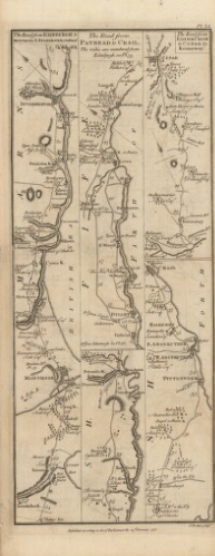
This dataset represents the complete descriptive metadata for the G Taylor and A Skinner’s Survey and maps of the roads of North Britain or Scotland, 1776, a digitised collection of George Taylor and Andrew Skinner’s volume of maps depicting roads in Scotland.
The images show roads across Scotland at one-inch to the mile scale, covering some 3,000 miles in total.
The original volume was designed to be folded into a portable accessory for the growing number of travellers and visitors in Scotland.
Rights information

This collection is free of known copyright restrictions. For details visit the Library’s copyright page.
Download the data
File contents: 1 readme file (plain text); 1 XML file in MARC format; 1 XML file in Dublin Core format.
File size: 10.0 KB compressed (289 KB uncompressed)